Sina Zekavat – Becoming A Post-Soviet City: Social Housing And Urban Planning In Yerevan
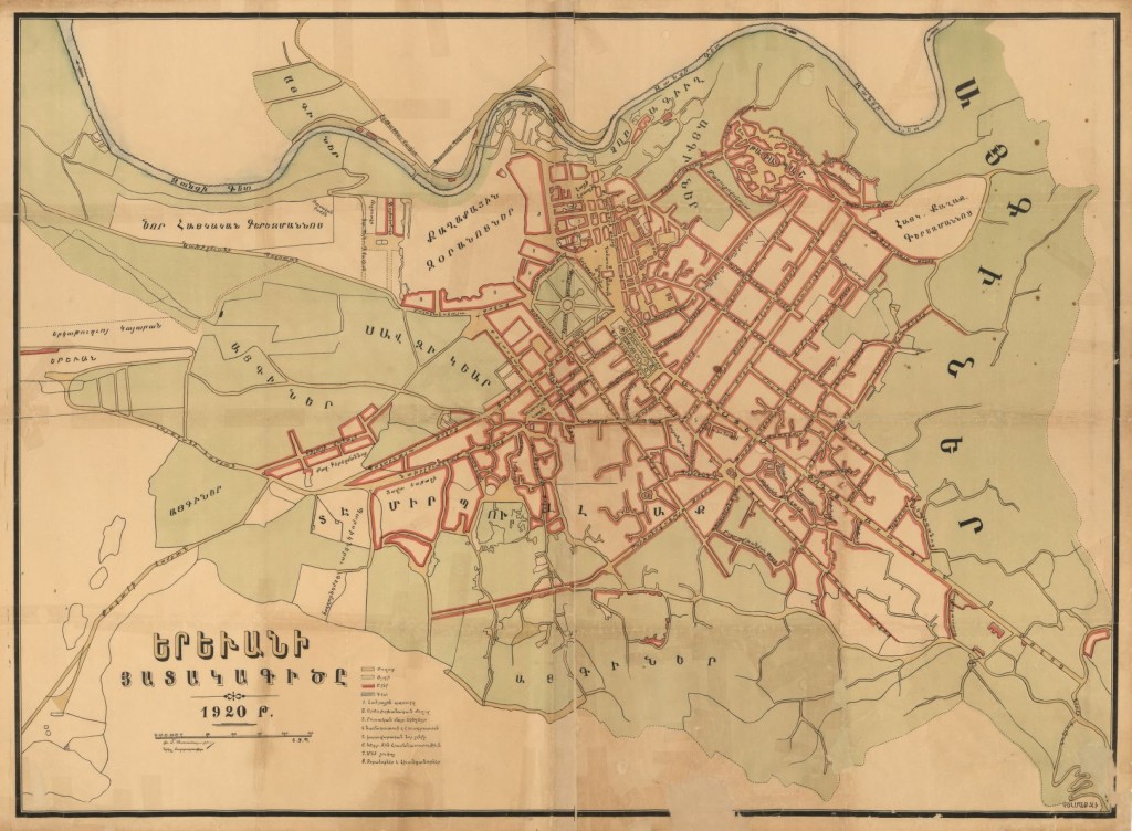
Map 1: First official map of Yerevan published in 1920 prior to the implementation of Tamanian’s radial plan.
ajammc.com. April 2014. It is impossible to walk around Yerevan today and not notice the melancholic presence of one building typology across this rapidly changing urban landscape: The Soviet social housing block. Far from being a clean break from the past, the Soviet housing legacy remains highly present and influential in the daily experience of Yerevan. These grey and often crumbling buildings constitute the largest share of housing in Armenia. Unlike some countries with longer capitalist heritages where social housing has become marginalized as a place for the poor, in Yerevan and in many other post-socialist Eurasian cities like Baku, Tbilisi and Tashkent, these housing blocks still provide the most common and accessible living conditions for average citizens.
Through careful observation of Yerevan’s Soviet housing legacy as well as Yerevan’s current transformations this article aims to explore the slow decay of socialism as a complex and multilayered process that symbolizes not simply the death of a particular utopia or ideology but also the emergence of new, and often conflicting, notions of belonging and nationhood.
Yerevan is the capital and the largest city of Armenia. With a population of 1.117 million, it contains approximately 34% of the total population and 54% of the urban population of Armenia. The city’s origin dates back to the 8th century BC when settlements started to grow along the banks of Hrazdan River at the northeast of the Ararat plain.
Read more: http://ajammc.com/yerevan-becoming-a-post-soviet-city/